
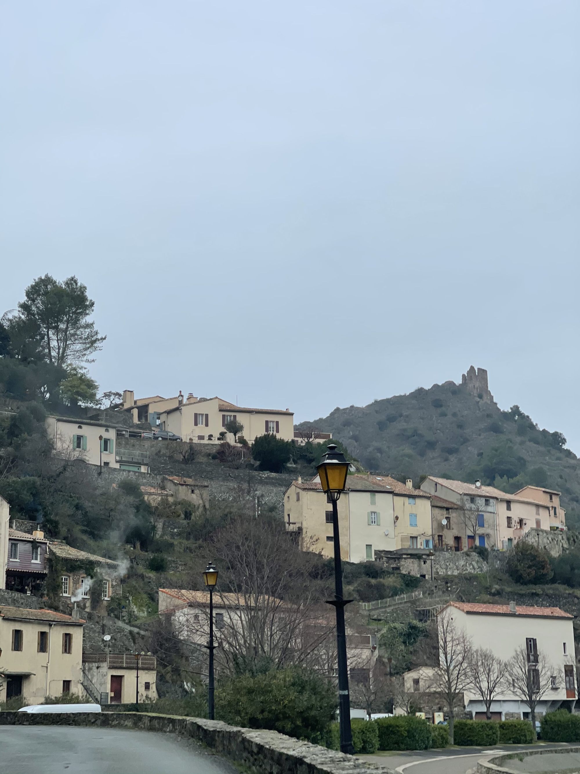
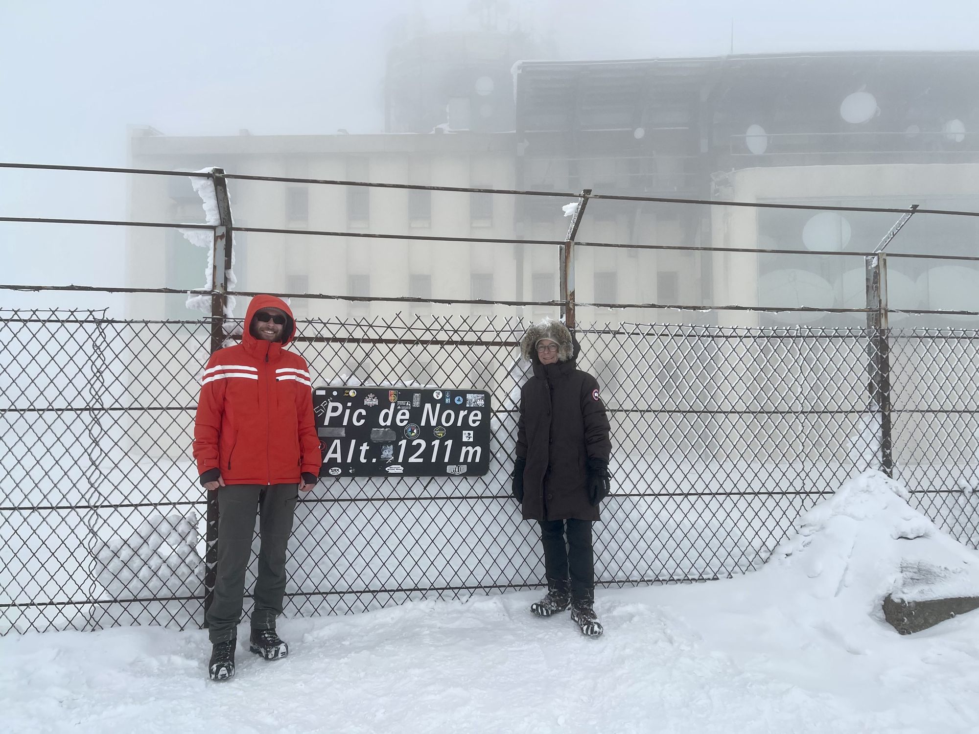
La montagne Noire (Black Mountain), a small mountain range on the foothills of the Massif Central is one of my favorite playgrounds for hiking, camping and cycling throughout the year. Located just an hour away from Toulouse, it’s a great getaway destination for a day or weekend. In the winter months, it’s also an alternative to the Pyrenees when the avalanche risk is too high or the weather too inclement. Although this time, we were heading there for the blizzard! The Pic de Nore (highest peak at 1211m) was supposedly completely covered in ice and snow. Our plan was to experience this unusual sight with a loop around the peak and a short ascension to its top.
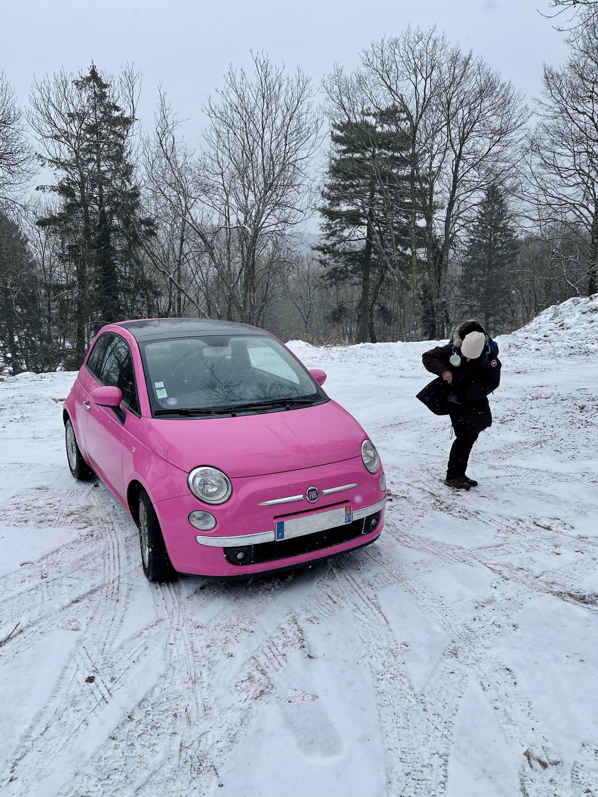
The small journey began with a drive towards Lastours, a village known for its impressive towers built on a rocky ridge in the 11th century. From there, we slowly and cautiously made our way up one of the few roads leading to Pradelles-Cabardès, our hike’s starting point. Our little pink Fiat 500 was definitely not suited for the job but still made it up like a champ.
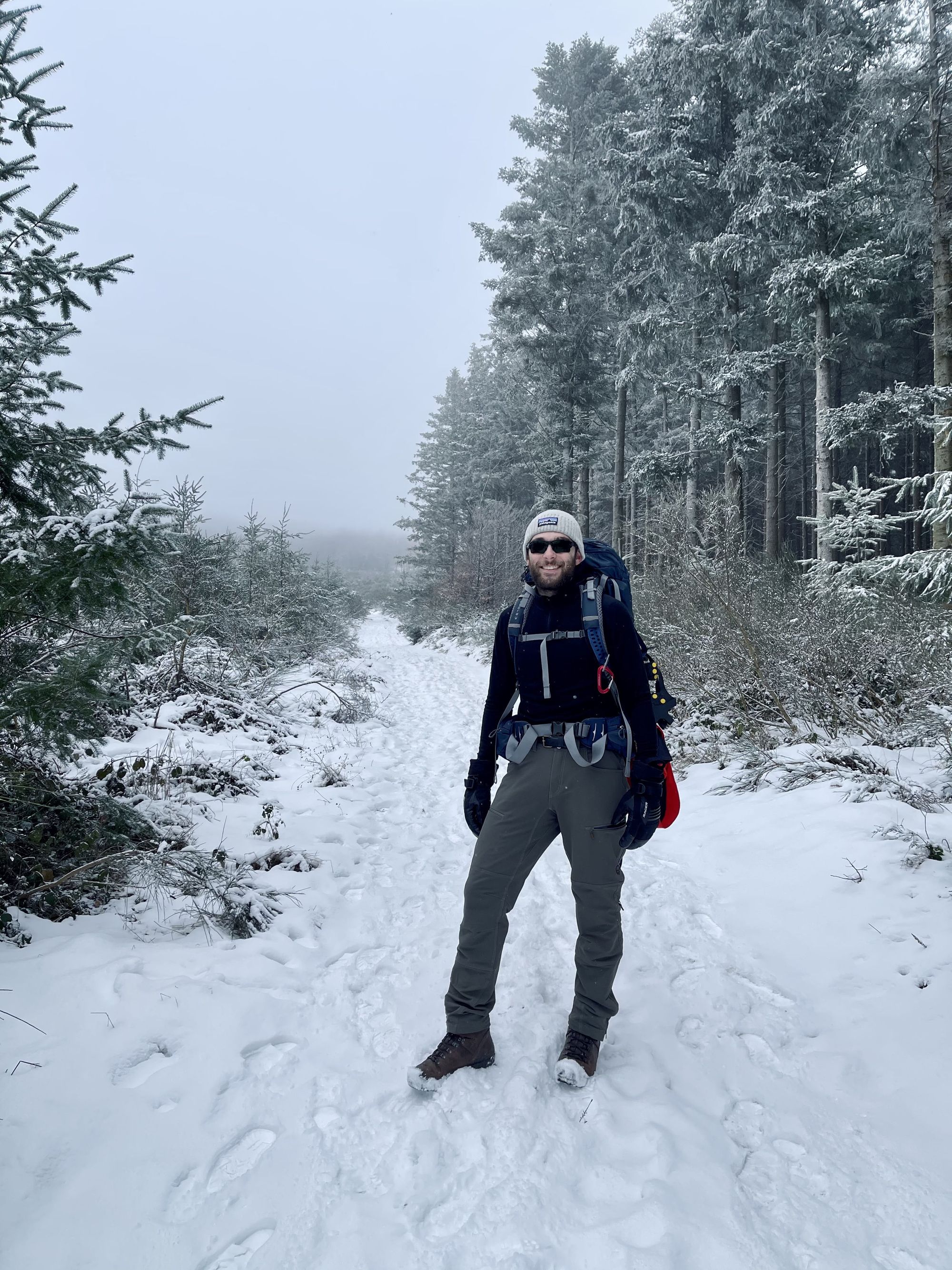
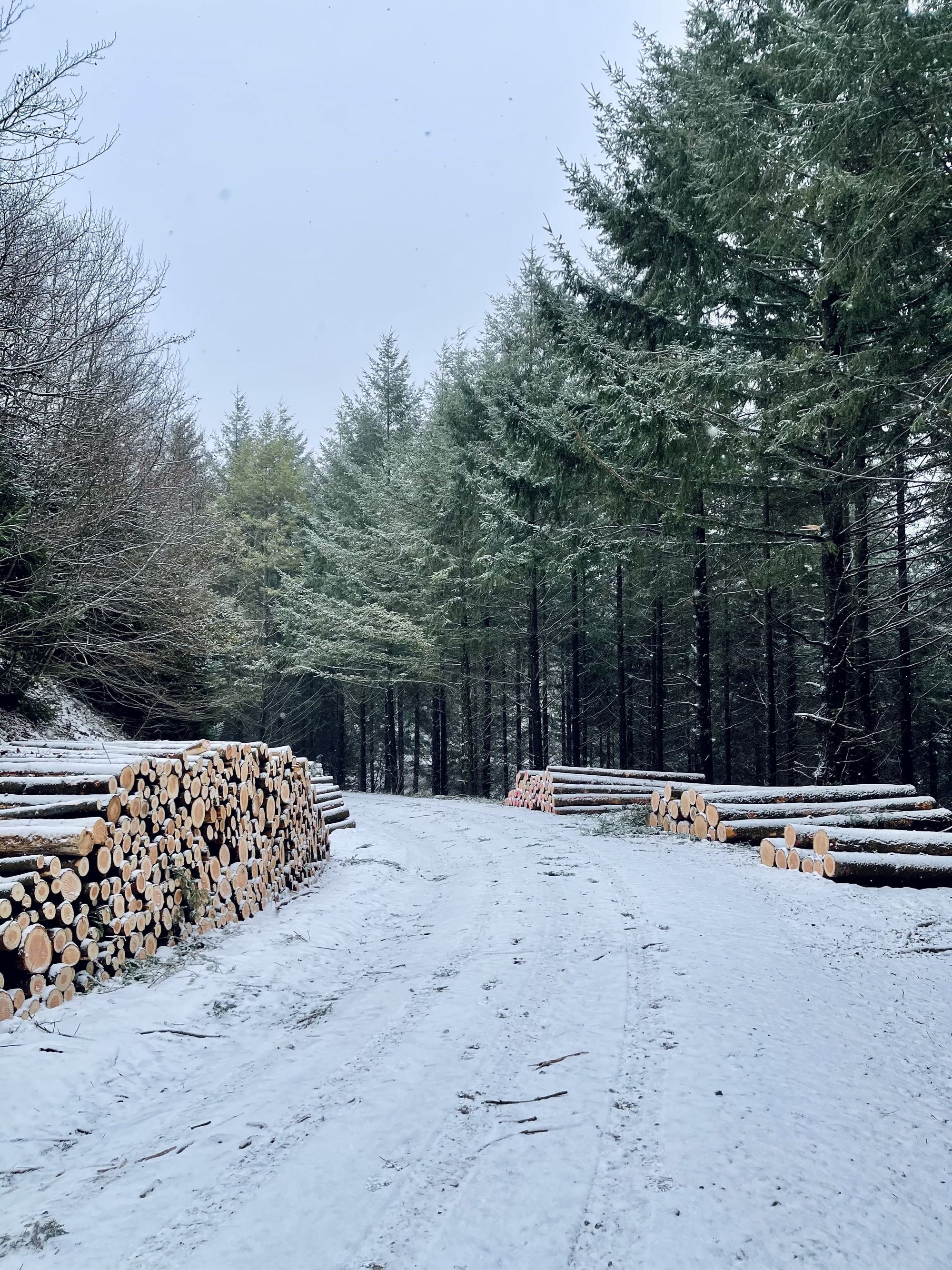
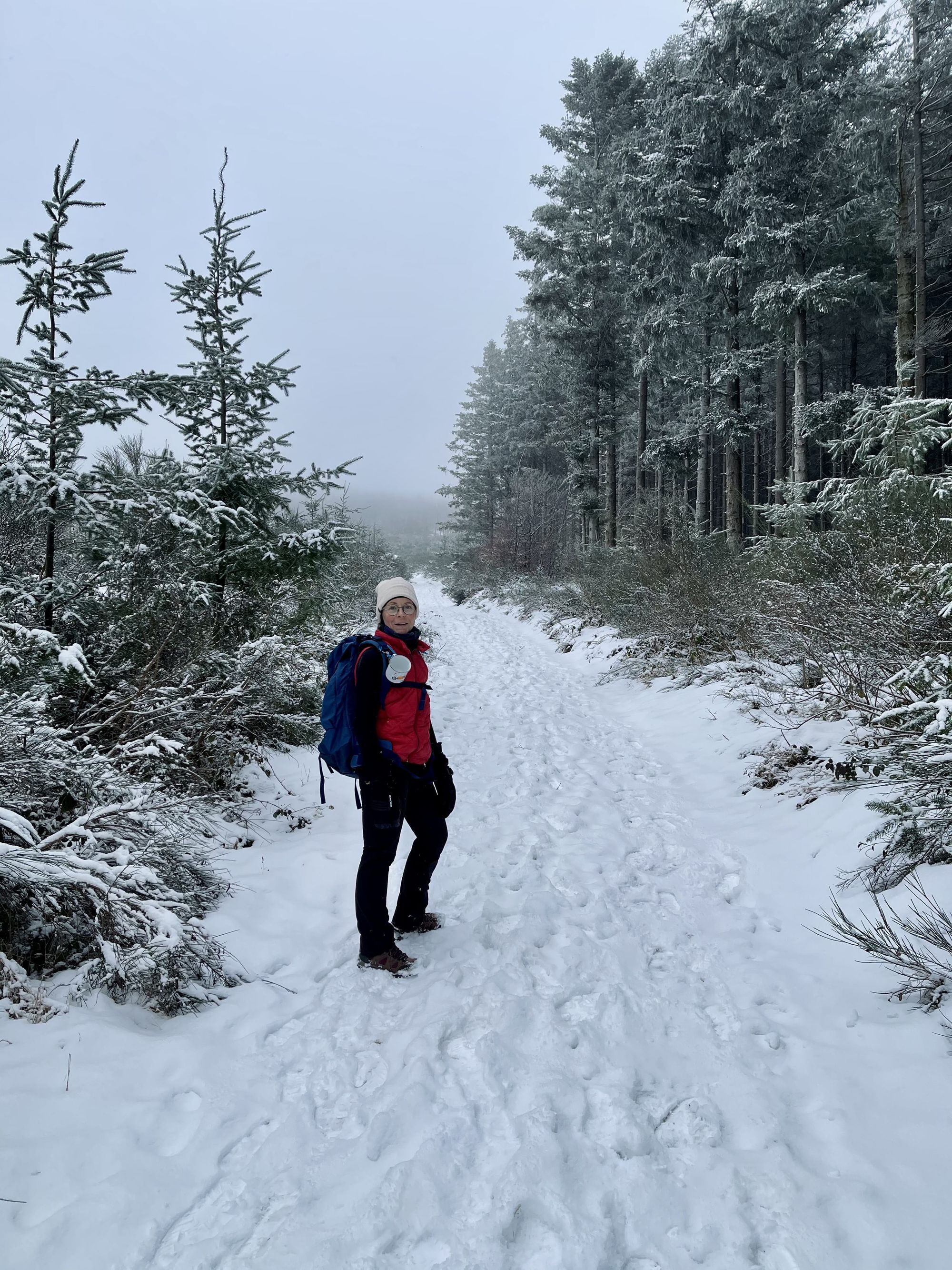
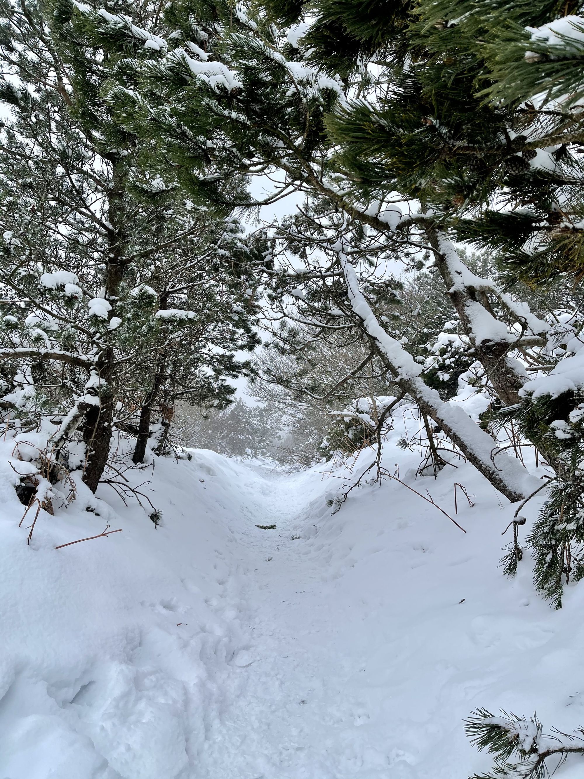
Getting out of the warm car into the cold was definitely the hardest part. Once fully dressed, we started our hike on mostly flats paths through a pine forest. The scent of freshly cut pine trees complemented the cold atmosphere opening up our lungs. However, just a few hundred meters in, the waist buckle of my mom’s (Valérie) backpack snapped in half due to the temperature shock. We stopped to re-arrange our bags and remove a few layers. In very cold temperatures, sweat can be very dangerous as it may freeze and create an ice layer around your body. We were now ready for our ascension towards the Pic de Nore.
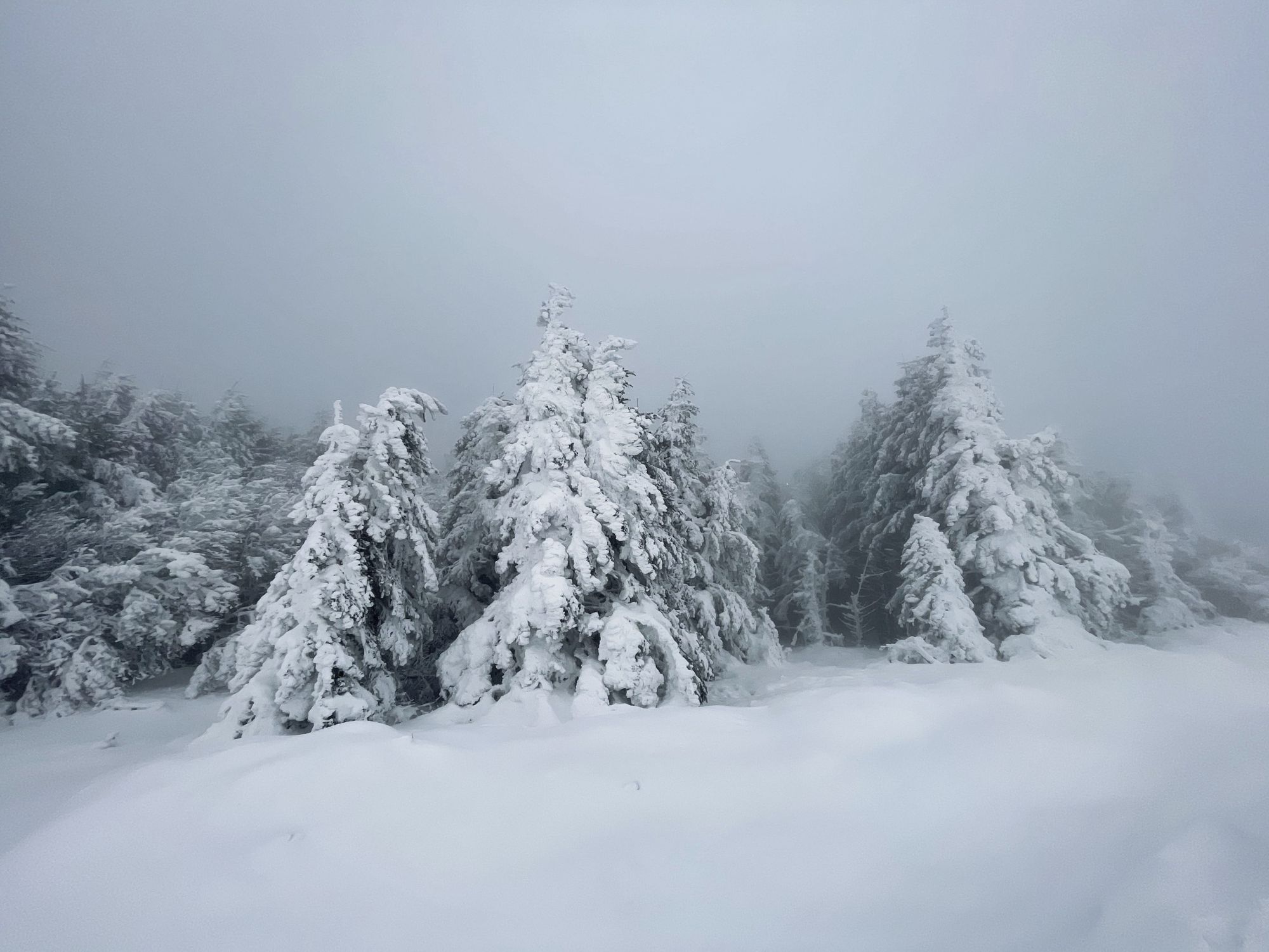
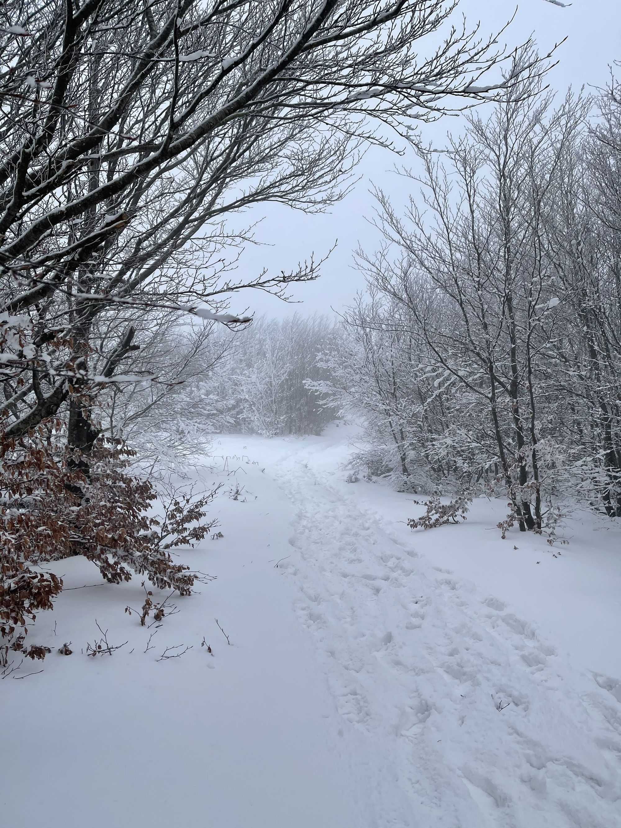
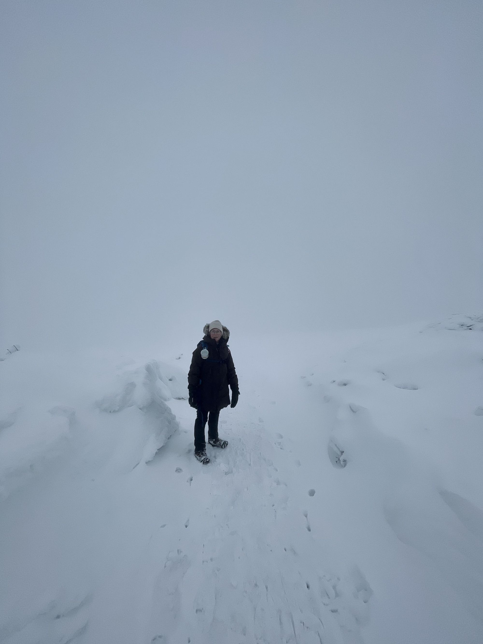
The higher we climbed, the more the blizzard intensified. We were left in awe at how much the landscape had changed. Normally, the area is referred to as balcony with stunning views over the Pyrenees. This time around, we couldn’t see more than a few meters before us. Nonetheless, this thick snow blanket reminded us of Canada or the Swedish Lapland and we were loving it.
As we closed in on the top, we met a native from Pradelles-Cabardès who told us he hadn’t seen this kind of weather in more than twenty years. In fact, back in the 19th century, the main economic activity in the region was the export of ice in the whole south of France. During the harsh winter months, the locals would store ice in large underground silos and transport it to the coast in the spring or summer. Nowadays, however, the rising temperatures mean that snowfalls and ice are a rare sight. This little historical fact made our hike even more memorable.
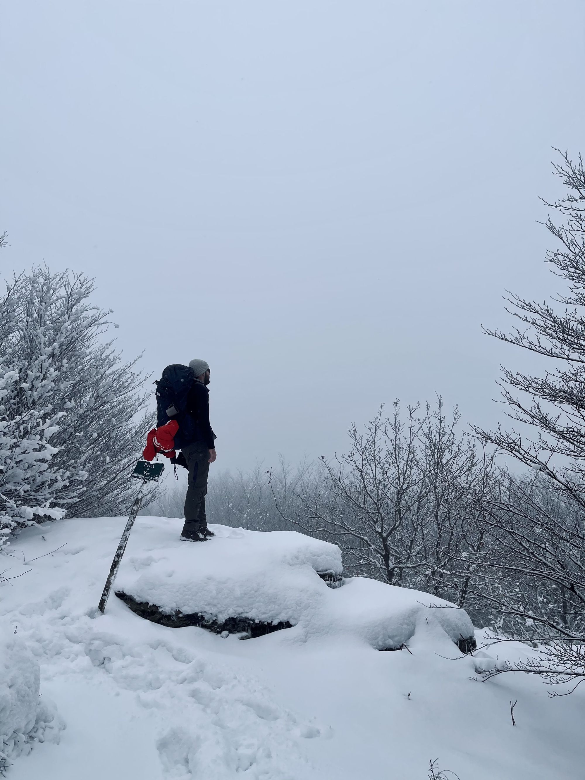
The ground was becoming more slippery, so we stopped once again to put spikes over our shoes. The last kilometers towards the top were intense. We were walking against strong winds and the complete lack of visibility made us dizzy. With no reference points in sight, our eyes had trouble focusing and even gave Valérie a headache. Although we had walked this path many times, I had to pull out my GPS for directions. Our footprints would immediately disappear behind us, so we had to stay very close in order not to lose each other.
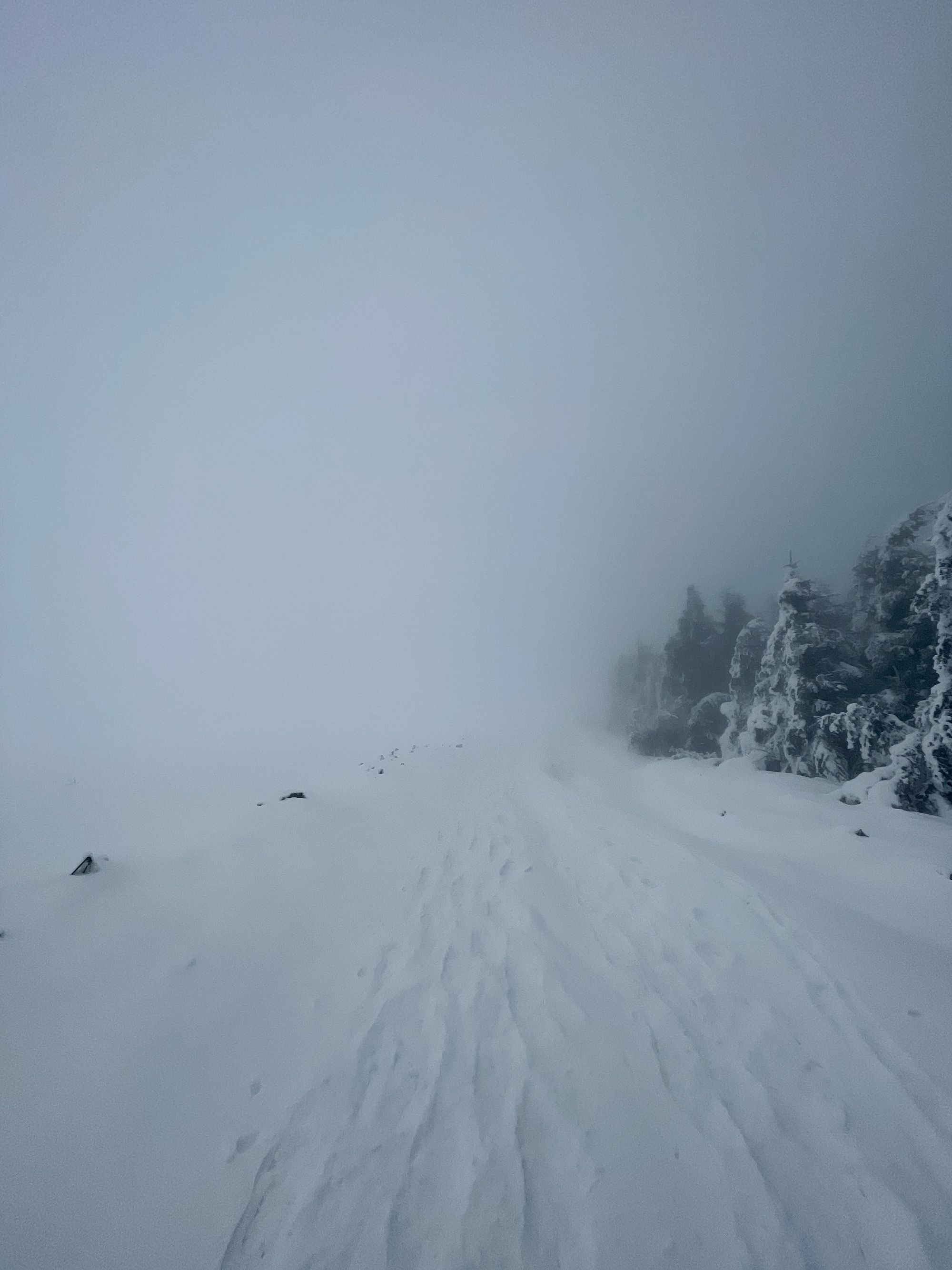
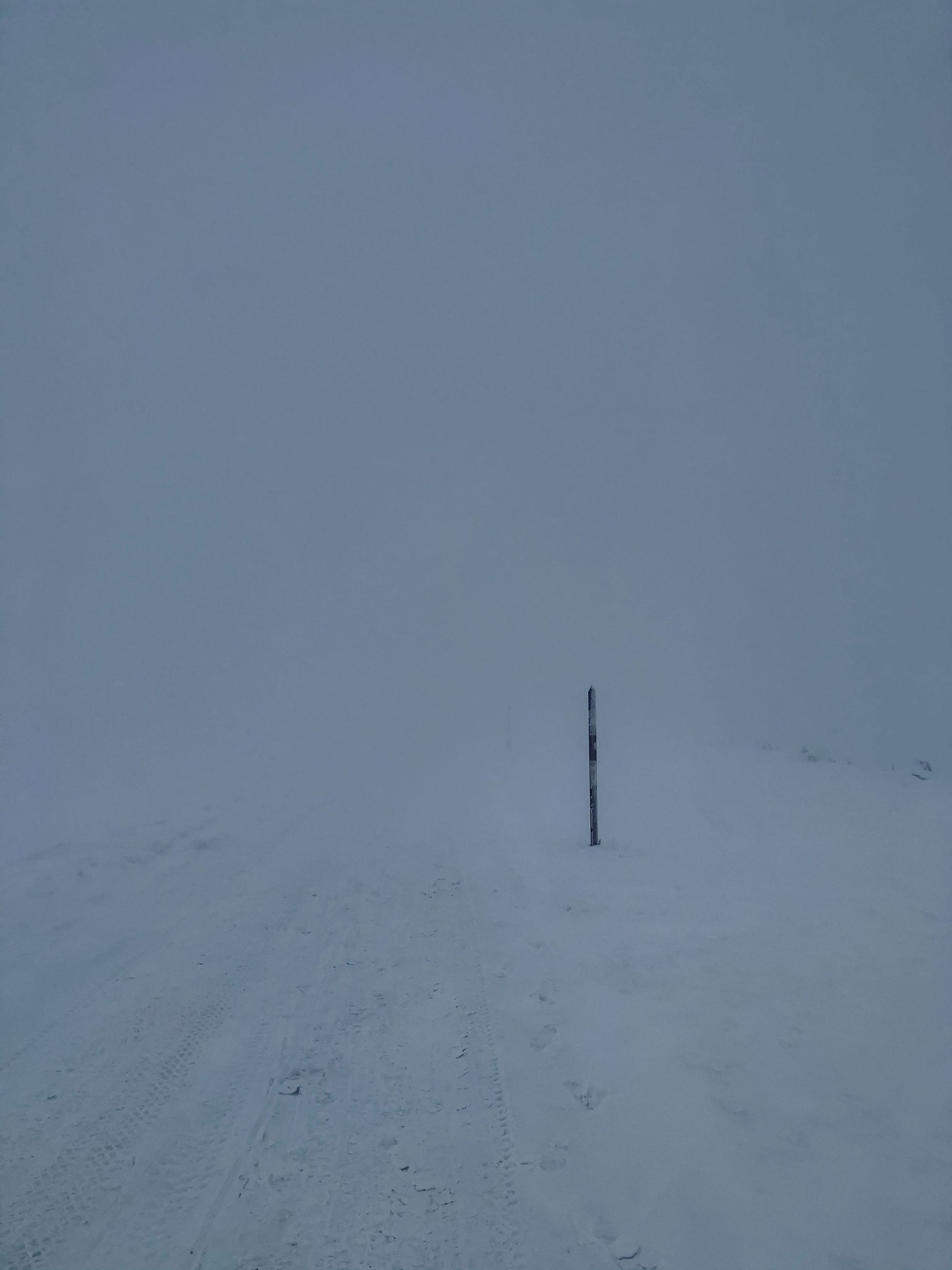
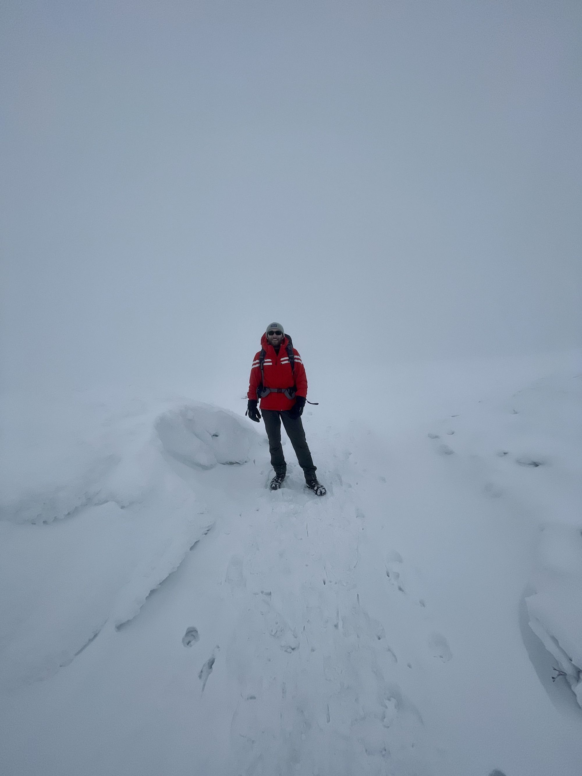

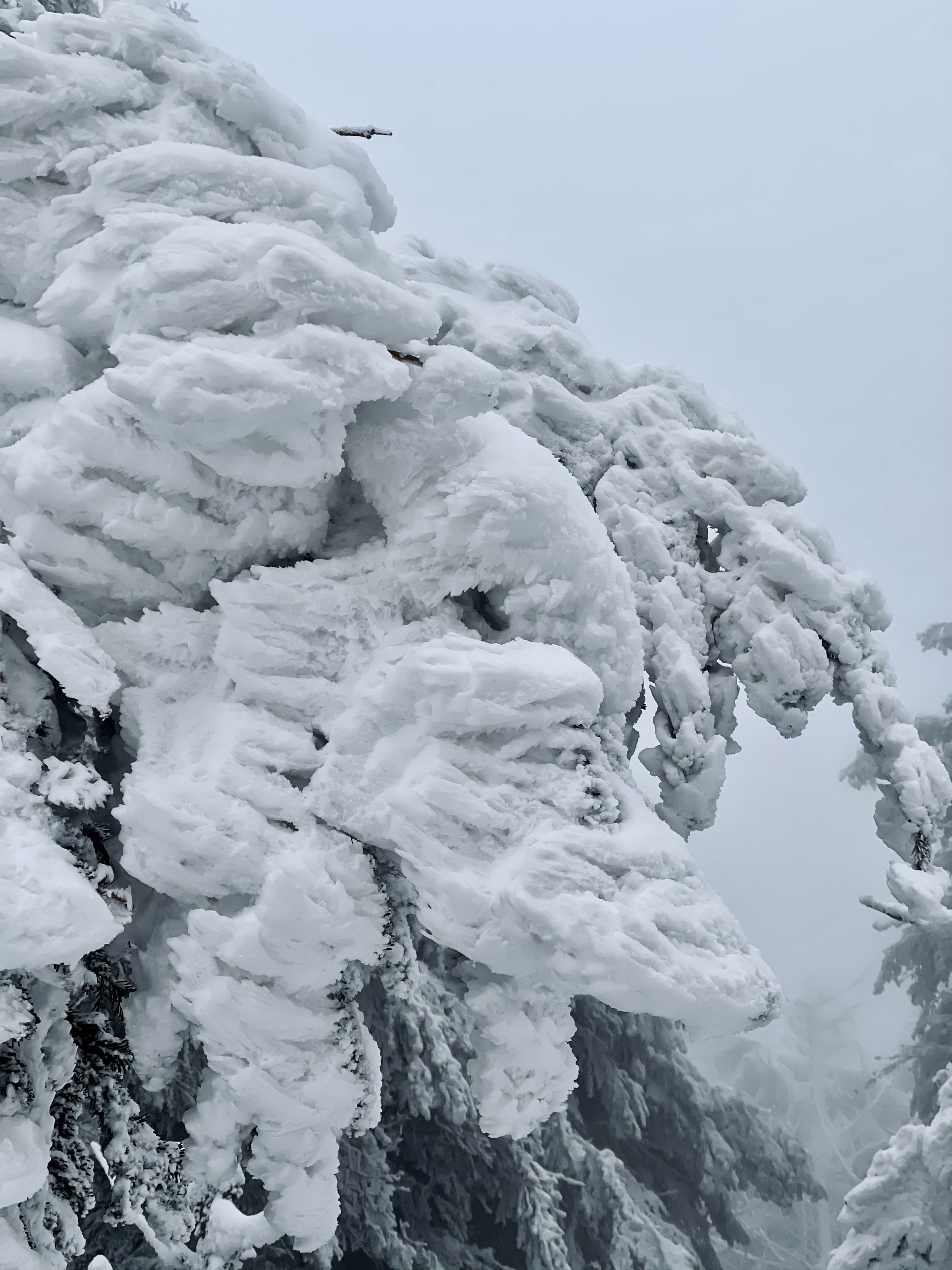
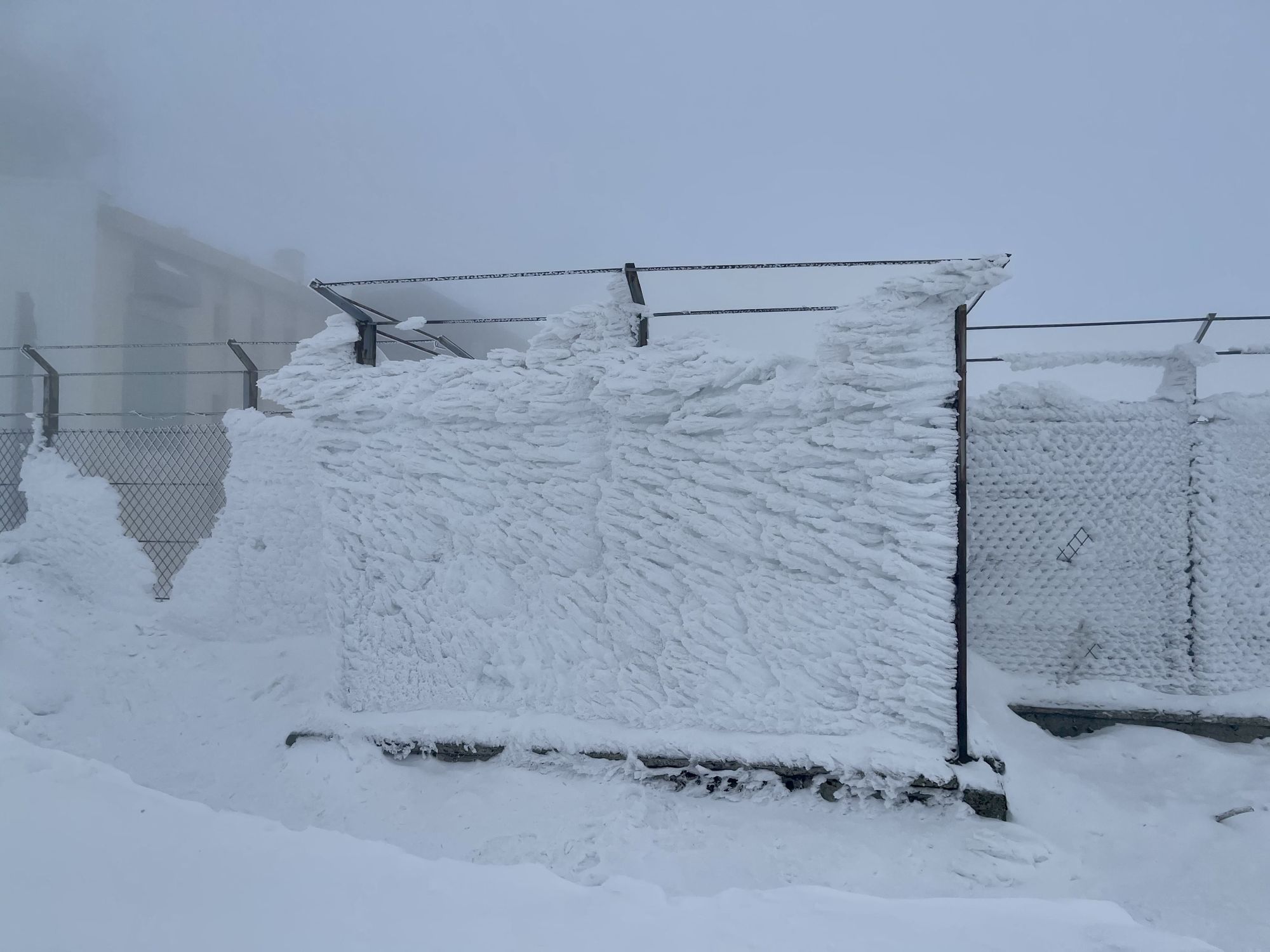
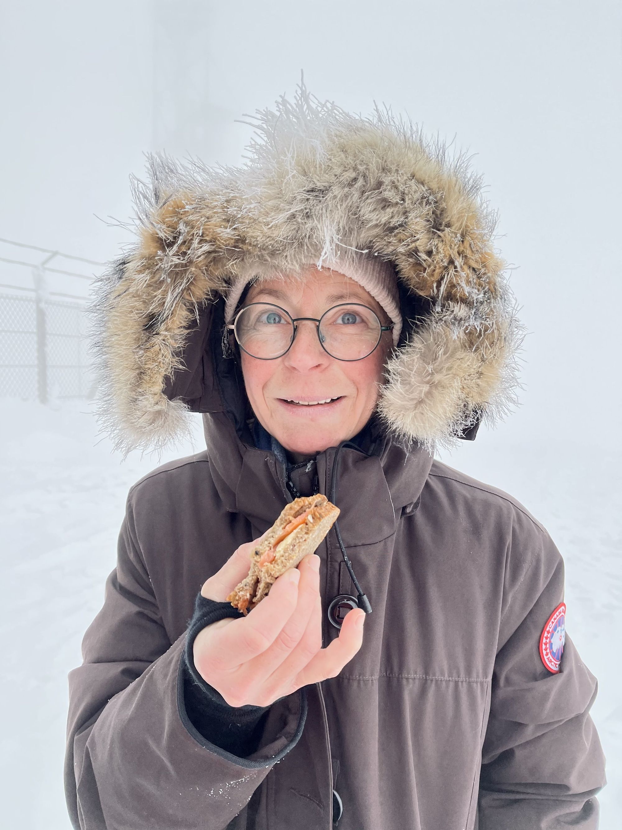
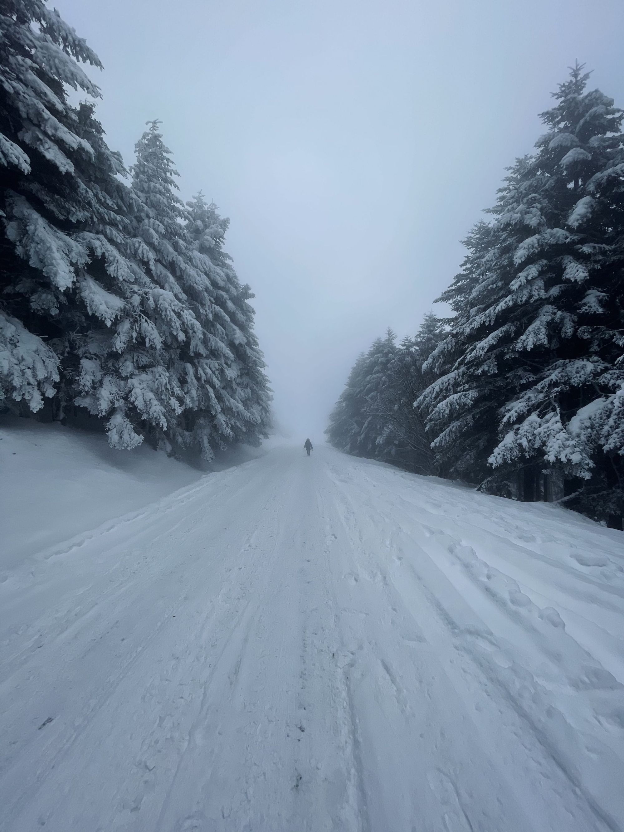
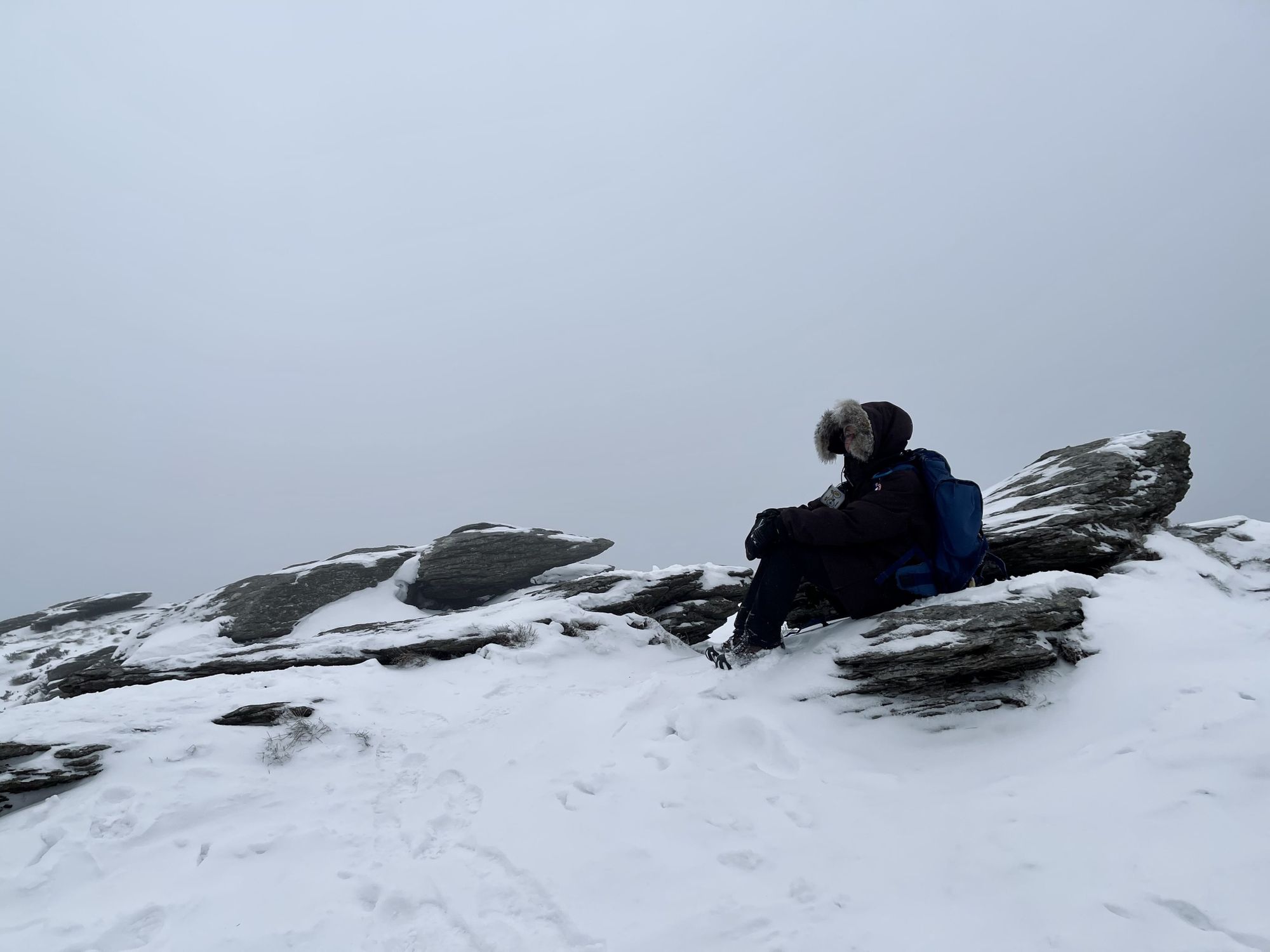
Finally, after a little over two hours, we reached the top. Up there, the landscape looked like another planet. Fences protecting the radio tower were covered in snow, shaped by the strong winds. We found a small sheltered spot against a wall and quickly ate our nordic inspired picnic. Before heading back down, we enjoyed a desperately needed hot coffee from our thermos. We asked a skier for a picture and started our descent. From our previous hikes, we knew that the descent was riskier than the ascension and resorted to following the road for the first kilometers. Soon enough, we were out of the blizzard and could see further than our feet. The foggy atmosphere, empty road, and white forest were a great composition for expedition worthy pictures.
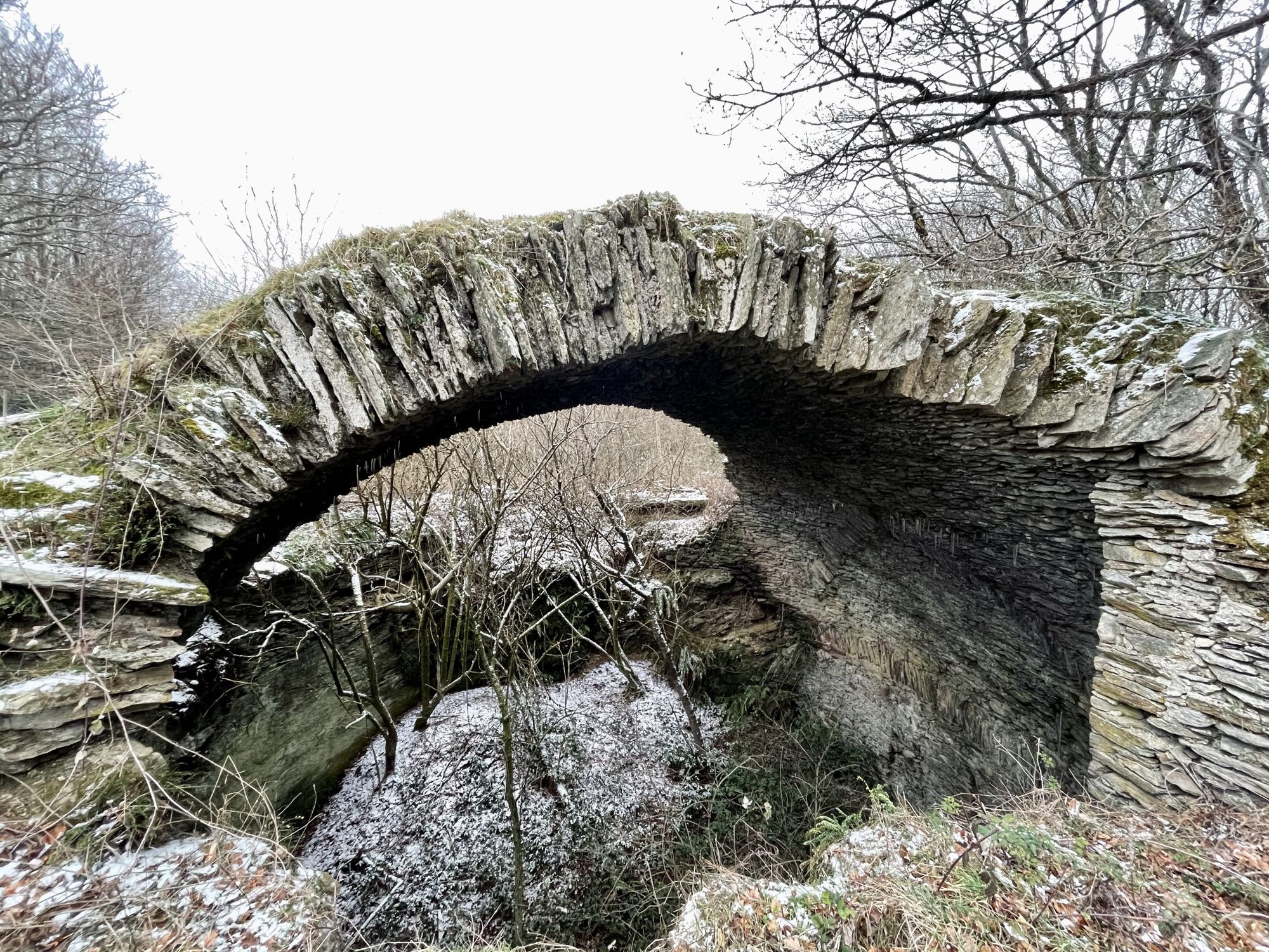
The rest of the descent was quite sketchy and we couldn’t take too many pictures. The path we borrowed was mostly carved by a now frozen water stream. We had to carefully place our feet one step at a time. In some sections, there was so much snow that we had to crawl our way through branches that would normally be above our heads. After a good hour, we were finally able to remove our spikes and walk normally. We were closing in on the end of our loop, and a few kilometers later, after passing by ruins of ice silos, we made it back to our car.
Although the hike wasn’t very long, we had spent more than five hours on the loop and were pretty exhausted. On our drive back to Toulouse, we had time to think about how much the weather had transformed a place we thought we knew like the back of our hand. We felt lucky to have had the chance to experience an increasingly rare snowstorm at the top of the Pic de Nore.
As always, you can check the route and the activity on Strava using the link below. If you’re in the area, I highly recommend our route for a scenic hike overlooking the Pyrenees.